Wednesday, August 24, 2011

Map of the Week - About that Earthquake

So we had this earthquake yesterday. OK 5.8 is nothing by west coast standards but when it happens on the east coast it's really important! I'd love to see a map of all the tweets because they apparently traveled quicker than the quake itself. There were reports of people seeing the tweets before feeling the quake. Of all the maps out there, this one from Joe Hanson is clearly the most informative.   


Anyway, the Baltimore Sun shows this map from the USGS showing the intensity felt by color. They use a detailed questionnaire to make it a bit less subjective. 


Here is a link to other USGS maps. Hope you survived. I didn't feel a thing but I was on my bicycle and everything feels bumpy from there.

Wednesday, August 17, 2011

Map of the Week - Reverse Colonialism

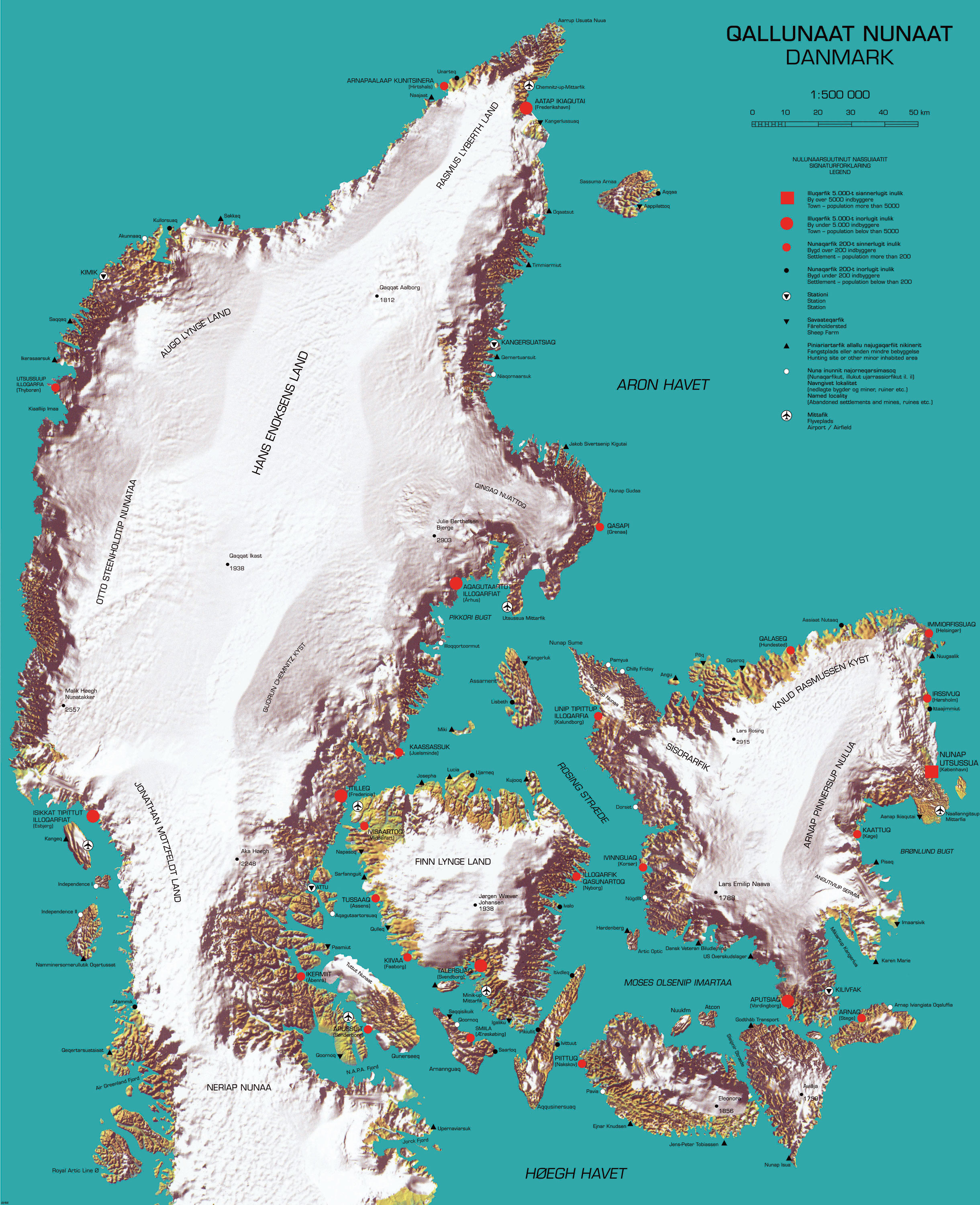
Here is a "cool" map that recently appeared on Strange Maps. It was produced by cinematographer and multimedia artist Inuk Silis Høegh for a project called "Melting Barricades," part of the  Rethinking Nordic Colonialism exhibit. The map pictures Denmark being colonized by Greenland, not just by the people but also by climate and topography.


Greenlandic names are imposed on places with the native Danish names in parentheses. The country name and title of the map is Qallunaat Nunaat (Danmark) and its largest city is Nunap Utsussua (København.) The coastline has become jagged from glacial erosion and the frozen interior named after native Greenlanders. The author also appears to have named a strait after himself, the Høegh Havet. 

There are a lot of details that escape me because I don't speak either of the languages and don't know my Illuqarfiks from my Nunaqarfiks. Some understandable (to English speakers) place names include "Chilly Friday" and "Air Greenland Fjord." 


Høegh also made a video called Attack-atigiit showing the Greenlandic occupation of Denmark. The language barrier prevents me from all the clever details but the general picture is clear. Below are some stills. The first one shows quizzical Danes studying the above map. At least I think that's the idea.


In this one Greenland is shown on a world map as a Mercator Giant, planting its flags around the world.