Germany is a country located in Europe, covering a land area of 357,021 square km. It is bordered by Denmark in the north, Poland and Czech Republic to the east, Austria and Switzerland to the south, and Belgium and the Netherlands to the northwest. The elevation of the country ranges from sea level on the North Sea coast, to 2962 meters (9718 feet) in the German Alps in the south of the country.
The country has a population of 81,799,000, making it the most populous country in the European Union, and the largest economy in Europe.
The majority of the country has a mild temperate climate, with rain occuring year round, summers being mild, and winters being cool. Eastern Germany has a continental climate with more extreme conditions, making the summers warmer and the winters colder.
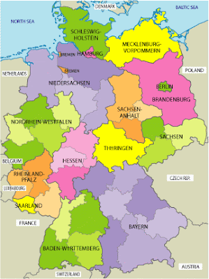
This first of the maps of Germany shows all of the country`s provinces.

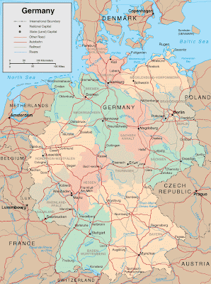
Here is a road map of Germany showing elevations and other details

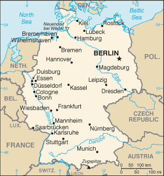
This last of the Germany maps is a very basic one but is good for using as a resource on a website, or for printing out when you just need a simple reference map.

I hope the above maps of Germany were what you were looking for!
No comments:
Post a Comment