Wednesday, April 4, 2012

Google's 8-bit Maps

Google released an 8-bit map "upgrade" this past weekend as an April Fool's joke. This upgrade was done to support the Nintendo Entertainment System as explained in the Google LatLong blog - the video at this link is pretty funny.

Here are some examples of our 8-bit fantasy-like world:

The lower Great Lakes with the important places like Aurora and West Virginia emphasized.

Westminster, London - zoom in to get cute building icons.

The pixellated coast of New Orleans

Yellowstone and vicinity

Sydney.

  
 Occasionally you will come across a game character like this guy near Scranton. If I was more into gaming I might know who this is.


Here's the googleplex area with its dinosaur and flamingoes. There's probably a joke or two here for those in the know.

If you zoom all the way to street view, the images are posterized for your fantasy viewing pleasure:


Click here to explore the 8 bit world.

Thursday, March 29, 2012

Random Thursday-Maps You Probably Won't Use Today

Have I mentioned that I don't really care for google (or bing or yahoo) maps? Sure they serve certain purposes very well and I even use them at work when they fit the bill. However, when directing me to your business I prefer a customized map. Here are some examples.

A map to the Kipu Ranch on Kauai where you can enjoy scenic beauty by ramming through it on an ATV.
Directions to Camp del Oro in Nevada City, California. You will probably get lost.


Raffles, an Asian restaurant in Nagoya, Japan. An Asian restaurant in Japan? What an idea!


The Book Loft of German Village - Columbus, Ohio. Absolutely not to scale but emphasizing the important details - and you can't do that in google!


Pasquia Regional Park in Saskatchewan- looks like it was drawn by a kid with cartographic skills.


A very red map of the locations of the Big R Stores in the Northwestern US. I love how the topography ends at the Idaho border!

Here's a map to The Strand - a development in Datarang Sunway, Malaysia. I got the image from Three Meals of Goodness, a Malaysian dining blog. I like the exaggerated earth curvature, and the Ikea.


Wednesday, March 21, 2012

A Six Pack of Maps

Spring beer season is here. If you look at the bottom of your six pack you may find a nice map directing you to the brewery. Just be careful not to turn it over when it's full of bottles. I like these maps because they are usually hand drawn (or in a hand drawn style) making for creative alternatives to the googly, bingy maps we've become accustomed to. Of course, most brewing companies use a google type map on their web sites so I had to scan some six packs.

Here are six examples from beers that are commonly available here in the Northeastern USA. I have a few others from farther afield that will make for a future post. This is not meant as an endorsement of these beers. They are just the ones I've bought in six packs recently and some of them were better than others.

From Maine - the Belfast Bay Brewing Company.

Magic Hat in South Burlington, Vermont. I've actually been on this tour!


Victory - Downingtown, PA. A highly schematic map where 202 and 30 are really important while 476 and Route 1 don't make the cut.

While in Pennsylvania stop by Troegs - look for a beer bottle by the railroad tracks. They're moving to Hershey* though so this map may not help you anymore.


Circling up to western New York, there's the Southern Tier Brewing Company.

Finally we head back eastwards for a colorful map from the Ithaca Beer Company.


If you find a nice map on the bottom of your six pack send it over and maybe I'll put it in a future post.

*UPDATE - since I began collecting these Troeg's has in fact moved so I had to buy another six pack of their beer. Here's the map to their new digs with I-81's westward sweep greatly exaggerated for artistic effect - try doing that on a google map!


Friday, March 16, 2012

March Madness Redux

I've had a few inquiries about mapping the NCAA tournament. Bill's Sports Maps is still the best resource for figuring out where the heck Murray State is. Here's a piece of his big map. Click for the full page.


I'd love to give the women equal time but Bill didn't make a map of their tournament and I can't find one elsewhere. With Bill out on injured reserve it's unlikely we'll see one. Maybe if I strategically wait until the final four I can find the time to make my own. Go Great Danes!

Tuesday, March 13, 2012

Map of the Week-Burning Edition

Robert Ayres who created the burning Ponderosa map for Bonanza died recently.

This map is on permanent display at the Autry National Center in Los Angeles. Assuming that north is supposed to be up, the map was drawn incorrectly. When Ayres showed the map to series creator David Dortort he said "I love it, but your directions are wrong." Ayres fixed this by adding a compass with north pointing to the left and up. If only all cartographic problems could be solved this way.

Here's the map in action

For your viewing pleasure, here is the intro so you can watch it burn!


Thanks to my wife for the post suggestion and title.

Wednesday, March 7, 2012

The Geotagger's World Atlas

Eric Fischer's Flickr photostream has lots of interesting maps. He has put together The Geotagger's World Atlas, a series of maps showing the locations of geotagged images from Flickr and Picasa. These maps (all covering 15 square miles) reveal the contrasting patterns of world cities from the highly centralized European cities such as Amsterdam, to the sprawling multinodal Los Angeles.

The Geotaggers' World Atlas #47: Santa Monica and western Los AngelesThe Geotaggers' World Atlas #14: Amsterdam   

To add color and interest, he also has a set called Locals and Tourists with color coded dots - blue for locals red for tourists and yellow for not certain. Most cities have the red dots in the central areas and clustered at beaches, sports arenas and amusement parks. San Francisco (his hometown?) has a nice concentration of red all along the Golden Gate Bridge and red clusters in various tourist destinations, including Alcatraz.

Locals and Tourists #3 (GTWA #4): San Francisco

The lines in these maps connect pictures that were taken in a series.

Paris shows an east-west split. The red area at the lower left edge is probably Versailles.

Locals and Tourists #4 (GTWA #3): Paris

The Asian cities show some surprisingly spread out settlement patterns. Here is Taipei.Locals and Tourists #9 (GTWA #55): Taipei

I'll finish off with Tokyo and its nice, artistic pattern.
Locals and Tourists #5 (GTWA #20): Tokyo

Wednesday, February 29, 2012

Super Commuting

A new report from NYU's Rudin Center for Transportation Policy and Management details the rise of the "super commuter" - someone who commutes from one metropolitan area to another. The report is summarized in an article in the Atlantic Cities. This map shows "non-local labor sheds" for major U. S. cities.

The stars are the commuting destinations while the graduated circles represent the home areas of commuters from outside the region. I like the gratuitous inclusion of Puerto Rico at the bottom right of these maps.

According to the study, these commuters tend to be younger people with modest incomes and may be making these commutes to take advantage of more affordable housing. Many of them probably don't need to show up in the office more than a couple of times a week. Two of the top super commutes are Houston to Dallas and Dallas to Houston. Sounds like a recipe for a house swap reality show.

I grabbed this image directly from the report as a typical detail of one of these areas - in this case Chicago.


 The darker reds represent larger percentage increases. While Detroit had the largest percentage increase, it is still coming from a much smaller number of actual commuters,. Cities such as Champaign and Saint Louis had higher absolute increases. I don't know why Milwaukee is so much smaller than the other cities when it is so close by - better job market there?

Friday, February 24, 2012

Spying on Those You Care About

My wife is flying through thunderstorms from Philadelphia to Fort Myers, Florida. I just got a free iPhone app called "Flight Aware" so I can see where she is. You can also see the thunderstorms moving out to sea.


I can also see what kind of air traffic she'll be up against in the area.


And take look at the airport area to see how much more traveling she needs to do from the airport. This is almost as cool as Passur's live airport monitors!


UPDATE - she made it! Thank you airline industry!

Wednesday, February 22, 2012

Akihabara-Japan's Electronics Market

My September, 2008 issue of Nipponia magazine features Akihabara. This district of Tokyo has become the world's largest collection of electronics stores as well as a lifestyle mecca for fans of manga, anime and video games.
The printed copy has a large centerfold map of the district-here's a copy from their web site.


The red and dark blue dots are electronic stores and parts stores. Orange are computers and peripherals. Pink dots are pop culture stores and light blue dots are places that sell mini cars, train sets and robots. The map also shows you where you can get canned bread, o-den ("chunks of food") and other delicacies.

The green dots are maid cafes. These are cafes where you can live out your video game fantasies (aka cosplay) by being served by maids who will refer to you as "My Lord and Master" or "Your Ladyship" and may cast spells or draw pictures in ketchup on your food. Most customers are male - big surprise!


Wednesday, February 15, 2012

The Pennsylvania Underground Railroad

To honor black history month, I went digging for maps. While the Underground Railroad is only a piece of that history, it has some of the most interesting map content. I came across this nice map of Underground Railroad sites around Kennett Square in Chester County, Pennsylvania. Quakers from the area were active in the abolitionist movement. The map is from the Kennett Square Underground Railroad Center.


A large print of the map is available here. Below is a detail:


I also found this schematic of the area from the website of Singing Wid a Sword in Ma Han  - a musical docudrama of the Underground Railroad in Pennsylvania playing in New York City.


For a complete picture of the Railroad's breadth, here is a map from Slavery in America.


Sunday, February 12, 2012

Map of Lima Peru

Look below to find yourself a map of Lima Peru for your reference.

Lima is the capital city as well as the biggest city in the South American country of Peru. And when I say it`s the biggest city, I mean it`s a massive city - the biggest city by far. It has a whopping population of over 7.6 million in the city proper, and 8.5 million in the metropolitan area. That is approximately a third of the population of the entire country. It is situated in the center of Peru, on a desert plain that overlooks the Pacific. Its metropolitan area extends to the coast and incorporates the seaport of Callao. It is the fifth most populous city in Latin America, after Mexico City, Sao Paulo, Buenos Aires, and Rio de Janeiro.

The city was founded by the Spanish in 1535, and became the capital of the Spanish Viceroyalty of Peru. Then, after Peru gained its independence, Lima became the capital of the new Republic of Peru.

Lima is a major destination for tourists, especially the UNESCO World Heritage Sites of Lima and Rimac - the historical districts of the city. Other attractions include the beautiful and extravagant colonial architecture such of the Monastery of San Francisco, the Catherdral, Covenant of Santo Domingo, the Palace of Torre Tagle, and the Plaza Mayor.

The climate of desert is pleasant and comfortable, despite its location in a so-called subtropical desert. The summers (ie. winter in the northern hemisphere) are warm and dry, while the winters (summer in the northern hemisphere) are mild with little variation between day and night temperatures. Winter daily lows are between 12 to 16 degrees, and daily highs are between 16 to 19 degrees. And I`m talking degrees celsius, so don`t panic, Americans!

Map of Greater Lima Peru
Central Lima Map in Peru
Map of Lima for tourists

Were the above map of Lima Peru downloadable images what you had in mind when you visited this page? I hope so. Leave a comment and let me know what you think.

Saturday, February 11, 2012

Map of Shenzen SEZ

Down below the article there will be a map of Shenzen China for you to make good use of.

Shenzen is a large city located in southern China in Guandong Privice. It is located just north of Hong Kong, just beyond the border of the Hong Kong Special Administrative Region. Shenzen itself is a SEZ (special economic zone) created to capitalize on its proximity to Hong Kong. These SEZs have more economic flexibility and more business friendly environments than mainland China as a whole.

Before the creation of the SEZ in 1979, Shenzen was a sleepy little village, but huge amounts of foreign investment as well as economically-incentivized migration, made this a boom town of monstrous proportions. Its population is now larger than Hong Kong`s with over 10 million people.

Basically the same as Hong Kong`s, Shenzen`s climate is subtropical, with hot humid summers and mild winters that are fairly dry.

map of Shenzen
map of Shenzen China
Tourist map of Shenzen SEZ China

Enjoy your visit to Shenzen, China and I hope you find the above map of Shenzen collection useful in navigating this gigantic new city.

Friday, February 10, 2012

Map of Buenos Aires, Argentina

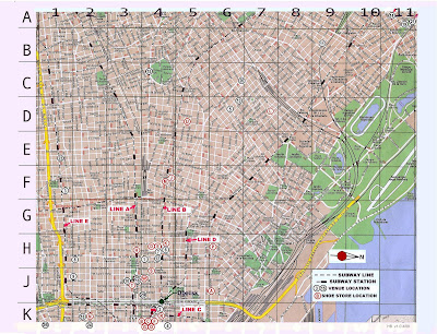
Check out a map of Buenos Aires, Argentina down at the bottom of the destination profile article.

Buenos Aires, Argentina is the most populous city in the South American country of Argentina, as well as its capital city. After Sao Paulo, Brazil Buenos Aires is the second-largest metropolitan area in the continent of South America. It has a city population of 2.9 million, and a metro population of around 12.8 million.

Strangely, the city of Buenos Aires is not the capital of Buenos Aires province - in fact, it is not a part of the province at all. It is its own autonomous district which is governed independently.

Buenos Aires is located in the southern hemisphere, which means that January is the hottest month. Summers are hot while winters are mild and sometimes cool, especially at night and in the early morning. Downtown Buenos Aires, near the ocean, rarely experiences frost, though some of the inland suburbs do in fact see frost on occasion.

Buenos Aires map
Big map of Buenos Aires Argentina
Argentina Buenos Aires map

How was the Buenos Aires, Argentina map collection above? Hopefully it served the purposes that you needed. Have a look to see if we offer any other map collections that you are interested in.